Chez Rodrigue — gîte / chalet in the “Grande-Terre” area, in Guadeloupe. The nearest beach is about 2.1 km away as the crow flies. Nearby: Porte d'Enfer (≈ 9.6 km).
At a glance
- Type
- Gîte / chalet
- Area
- Grande-Terre
- Coordinates
- 16.40724, -61.41941
Amenities
- Wi-Fi
As recorded in OpenStreetMap. An amenity missing from the list only means it has not been mapped — check with the property.
Location
- Beach
- ≈ 2.1 km as the crow flies — Plage de l'Anse des Corps
- Airport
- ≈ 20 km as the crow flies — Pointe-à-Pitre (PTP)
- Nearest sight
- Porte d'Enfer — ≈ 9.6 km
Orange dot: the property; green and blue dots: sights and beaches nearby. Map © OpenStreetMap contributors. Coordinates are approximate.
Around the property
A restaurant and a food shop are within 600 m: you can manage day to day without a car.
- Restaurants
- 5 within 1 km; nearest: Titi Pizza, ≈ 170 m
- Cafés and bars
- 2 within 1 km; nearest: ≈ 610 m
- Supermarkets and grocery shops
- 3 within 1 km; nearest: ≈ 590 m
- Bank or ATM
- nearest: La Banque Postale, ≈ 610 m
- Bus stops
- 7 within 1 km; nearest: ≈ 170 m
- Viewpoints
- nearest: ≈ 1.4 km
Straight-line distances based on OpenStreetMap: the actual route is longer, and a business missing from the map is not listed here. Check opening hours locally.
Things to see nearby
All sights on the island → Nature
Porte d'Enfer
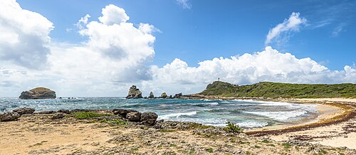
“Hell's Gate” — a lagoon among the cliffs of the wild north≈ 9.6 km
 Beach
La Caravelle beach
White sand, palms and calm water at Sainte-Anne≈ 21 km
 Beach
Bois Jolan beach
A shallow lagoon where you can wade far out knee-deep≈ 21 km
 Museum
Mémorial ACTe
The museum of the history of slavery and the slave trade in Pointe-à-Pitre≈ 23 km
 Hike
Pointe des Châteaux
A castle-like headland at the eastern end of Grande-Terre, looking out to La Désirade≈ 31 km
 Hike
Cascade aux Écrevisses
A short walk to a waterfall beside the Route de la Traversée≈ 37 km
Tours nearby
All tours on the island → Rum, wine, vanilla
Guadeloupe's rum distilleriesAgricultural rum, from the cane to the tasting
2–3 hAll year; production February — June≈ 14 km
 Sea and lagoon
Petite-Terre nature reserveTwo uninhabited islets: iguanas, a lagoon and a lighthouse
A full dayDecember — June; visitor numbers are limited≈ 24 km
 Sea and lagoon
The Grand Cul-de-Sac Marin lagoonMangroves, sand islets and a barrier reef by boat from Sainte-Rose
Half a day to a full dayAll year≈ 31 km
Photos and reviews
There is no free photo of the property itself: those on Booking, Google Maps and hotel websites are protected by copyright, so we cannot reuse them. Photos of the property and guest reviews are on its Google Maps listing and on booking platforms.
Other places to stay nearby
The whole area: Grande-Terre →
Where this data comes from
This property comes from OpenStreetMap (n9422904739), where it was added by the project's contributors. Accommodation data comes from OpenStreetMap: the list is incomplete and may lag behind reality. We do not sell stays and do not know prices: check availability, rates and reviews through the links to booking platforms.
Spotted a mistake? Fix the entry directly in OpenStreetMap: the correction will appear here at the next update.