A walk across solidified lava to the rim of the volcano's main crater
At a glance
- Category
- Hikes
- Distance
- 11 km
- Elevation gain
- 500 m
- Time
- 5–6 h
- Difficulty
- 3 out of 5
- Water on the route
- No — carry 2 litres
- With children
- From age 10–12, if they are used to hiking
- Best time
- All year when the Enclos is open; start before 8 am
- Places to stay nearby
- 5 places to stay within 10 km
The most popular route on the volcano: from the Pas de Bellecombe lookout, down 527 steps into the Enclos Fouqué caldera and across the lava field to the rim of the Dolomieu crater.
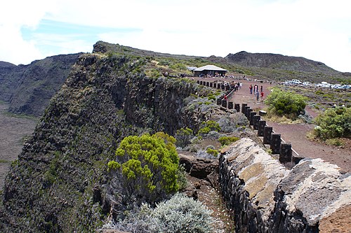
Pas de Bellecombe → floor of the Enclos. A short but steep descent by a staircase in the cliff (about 150 m of height). Check at the gate that the way is open: it is locked when an eruption threatens.
The lava field and Formica Leo. The trail is marked with white paint spots on the rock — do not leave it: there can be voids beneath the lava crust. On the left is the small scoria cone of Formica Leo. Further on, a gentle climb over ropy lava.
The crater rim. The Dolomieu crater is about 200 m deep. Stay behind the markings: the edges collapse. Return the same way; the climb back up the steps at the end is the hardest part.
- In fog the markings are easy to lose — turn back
- Sun and wind at 2,300 m are harsher than they seem
- Check the volcano's status before you set out
- The drive to Pas de Bellecombe is about 1.5 h from Saint-Pierre
On the map
Orange dots: places to stay nearby. Map © OpenStreetMap contributors. Coordinates are approximate.
Where to stay nearby: To the Dolomieu crater
All places to stay in the area →

Distance from the sight as the crow flies: Le Mahavel — 9.7 km; Ferme et Auberge Le Rond de Basse Vallée — 12 km; Chalet Piton des Songes — 12 km; Gîte Piton Mahot — 13 km.
Tours nearby
All tours on the island →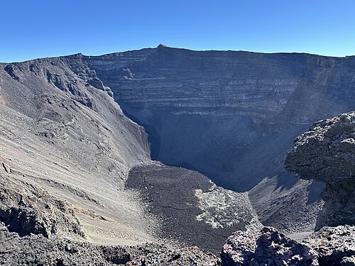 Guided hikes
Dolomieu crater with a guideA climb up Piton de la Fournaise with the volcano explained on the way
5–6 hDrier May — November; start at dawn≈ 3.9 km
 Canyons and thrills
Lava tunnels of the 2004 flowDown with a helmet and headlamp into the tubes where lava once ran
3–4 hAll year, except days of heavy rain≈ 9.3 km
 Rum, wine, vanilla
Vanilla in the east and rum distilleriesBourbon vanilla plantations and a rum museum in an old distillery
2–4 hAll year≈ 16 km
More to see nearby
 Viewpoint
Pas de Bellecombe lookout
The rim of the caldera, facing the volcano's crater≈ 3.9 km
 Nature
Plaine des Sables
A Martian landscape of red scoria on the road to the volcano≈ 6.7 km
 Nature
Grand Galet waterfall (Langevin)
A wide waterfall and freshwater pools in the Langevin valley≈ 9.1 km
 Nature
Anse des Cascades
A bay with waterfalls, palms and fishing boats≈ 14 km
Opening hours, prices and rules are a rough guide: check official websites before you go.