A climb to the highest point of Les Saintes, to the tower and a panorama of the bay
At a glance
- Category
- Hikes
- Area
- Les Saintes
- Distance
- 4 km
- Elevation gain
- 300 m
- Time
- 1.5–2 h
- Difficulty
- 2 out of 5
- With children
- From age 7
- Best time
- Morning
- Places to stay nearby
- 3 places to stay within 1 km
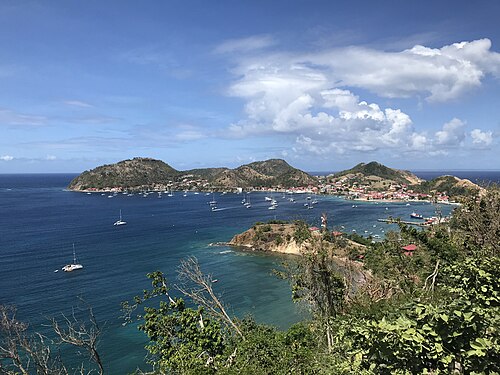
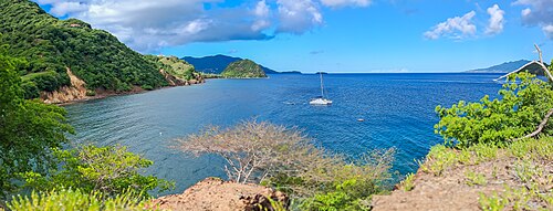
A concrete road climbs from the village of Terre-de-Haut to the tower on top of Le Chameau (309 m): views of the bay, Fort Napoléon and Basse-Terre.
Route. A steep climb up a road with no shade — about 45 minutes. At the top is an old watchtower.
- Go early in the morning — it gets hot
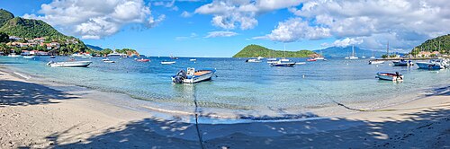
- Combine it with Pompierre beach after the descent
On the map
Orange dots: places to stay nearby. Map © OpenStreetMap contributors. Coordinates are approximate.
Where to stay nearby: Le Chameau on Terre-de-Haut
All places to stay in the area →




Distance from the sight as the crow flies: Hôtel Bois Joli — 80 m; Boone Vacances — 270 m; Chez Caroline & Richard — 970 m; Villa Hermine — 1.0 km.
Tours nearby
All tours on the island → History and towns
A day on Les SaintesBy ferry to Terre-de-Haut: the bay, Fort Napoléon and Pompierre beach
A full dayAll year≈ 1.1 km
 Guided hikes
Climbing La Soufrière with a guideAn active volcano, 1,467 m: fumaroles and a view over the archipelago
4–5 hDrier December — May; start early in the morning≈ 20 km
 Canyons and thrills
Canyoning and rivers of Basse-TerreJumps, abseils and swims in forest gorges
Half a dayDecember — May≈ 28 km
More to see nearby
 History
Fort Napoléon
A 19th-century fort with a cactus garden and a view of the bay≈ 1.9 km
 Beach
Pompierre beach
A sheltered cove on Les Saintes with goats and iguanas≈ 2.5 km
 Hike
La Soufrière from Bains Jaunes
A climb to the highest point in the Lesser Antilles through cloud forest≈ 22 km
 Hike
Carbet Falls
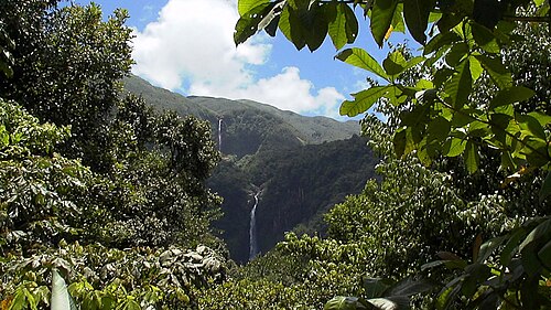
Guadeloupe's most famous waterfall, along a built path through the forest≈ 23 km
Opening hours, prices and rules are a rough guide: check official websites before you go.