Les Coeurs d'Amants — guest house in the “The south” area, on Réunion. The nearest beach is about 2.7 km away as the crow flies. Nearby: Grande Anse (≈ 5.9 km).
At a glance
- Type
- Guest house
- Area
- The south
- Phone
- +262 262 230 151
- Website
- official website
- Coordinates
- -21.35574, 55.60539
Amenities
- Wi-Fi
- Wheelchair accessible
As recorded in OpenStreetMap. An amenity missing from the list only means it has not been mapped — check with the property.
Location
- Beach
- ≈ 2.7 km as the crow flies — Ti-Sable
- Airport
- ≈ 19 km as the crow flies — Pierrefonds (ZSE)
- Nearest sight
- Grande Anse — ≈ 5.9 km
Orange dot: the property; green and blue dots: sights and beaches nearby. Map © OpenStreetMap contributors. Coordinates are approximate.
Around the property
No restaurant or food shop is mapped within 1 km: plan on having a car and shop on the way.
- Restaurants
- nearest: McDonald's, ≈ 1.9 km
- Cafés and bars
- nearest: Le gagnant, ≈ 1.1 km
- Supermarkets and grocery shops
- nearest: Centre Commercial E. Leclerc, ≈ 1.9 km
- Bakeries
- nearest: Paul, ≈ 1.9 km
- Pharmacy
- nearest: Pharmacie des Lianes, ≈ 1.0 km
- Doctor, clinic or hospital
- nearest: Clinique Saint-Joseph, ≈ 2.6 km
- Bank or ATM
- nearest: ≈ 1.9 km
- Petrol station
- nearest: Vito, ≈ 1.2 km
- Bus stops
- nearest: ≈ 1.9 km
- Viewpoints
- 2 within 1 km; nearest: Piton de l'Entonnoir, ≈ 680 m
Straight-line distances based on OpenStreetMap: the actual route is longer, and a business missing from the map is not listed here. Check opening hours locally.
Rent a car
Without a car, day-to-day life at this property is difficult. Book your rental before you leave: in high season the island agencies sell out quickly.
Things to see nearby
All sights on the island → Beach
Grande Anse
A white-sand beach with a stone-walled swimming pool≈ 5.9 km
 Nature
Grand Galet waterfall (Langevin)
A wide waterfall and freshwater pools in the Langevin valley≈ 7.4 km
 Beach
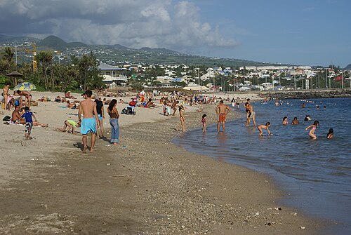
Saint-Pierre beach
A town beach with a lagoon, next to the seafront and restaurants≈ 14 km
 Nature
Plaine des Sables
A Martian landscape of red scoria on the road to the volcano≈ 15 km
 Hike
To the Dolomieu crater
A walk across solidified lava to the rim of the volcano's main crater≈ 16 km
 Museum
Cité du Volcan
The volcanology museum at Plaine des Cafres≈ 17 km
Tours nearby
All tours on the island →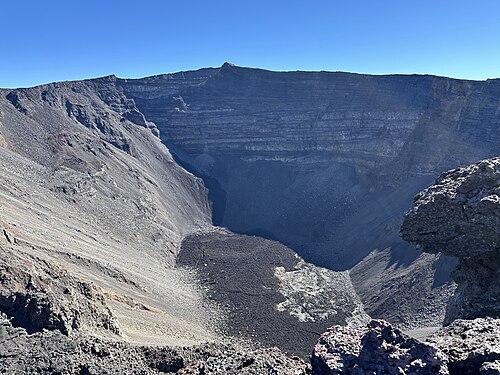 Guided hikes
Dolomieu crater with a guideA climb up Piton de la Fournaise with the volcano explained on the way
5–6 hDrier May — November; start at dawn≈ 18 km
 Canyons and thrills
Lava tunnels of the 2004 flowDown with a helmet and headlamp into the tubes where lava once ran
3–4 hAll year, except days of heavy rain≈ 21 km
 Canyons and thrills
Canyoning in Cilaos and SalazieWaterfall descents, from beginner canyons to sporting ones
Half a day to a full dayMay — November≈ 28 km
Photos and reviews
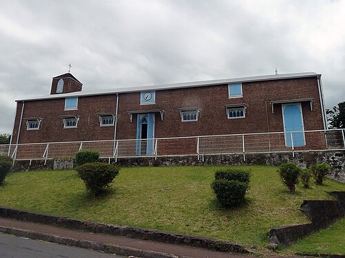
There is no free photo of the property itself: those on Booking, Google Maps and hotel websites are protected by copyright, so we cannot reuse them. The photo above, from Wikimedia Commons, was taken close by: it shows the place, not the property. Photos of the property and guest reviews are on its Google Maps listing and on booking platforms.
Other places to stay nearby
The whole area: The south →


Where this data comes from
This property comes from OpenStreetMap (n3034260601), where it was added by the project's contributors. Accommodation data comes from OpenStreetMap: the list is incomplete and may lag behind reality. We do not sell stays and do not know prices: check availability, rates and reviews through the links to booking platforms.
Spotted a mistake? Fix the entry directly in OpenStreetMap: the correction will appear here at the next update.